


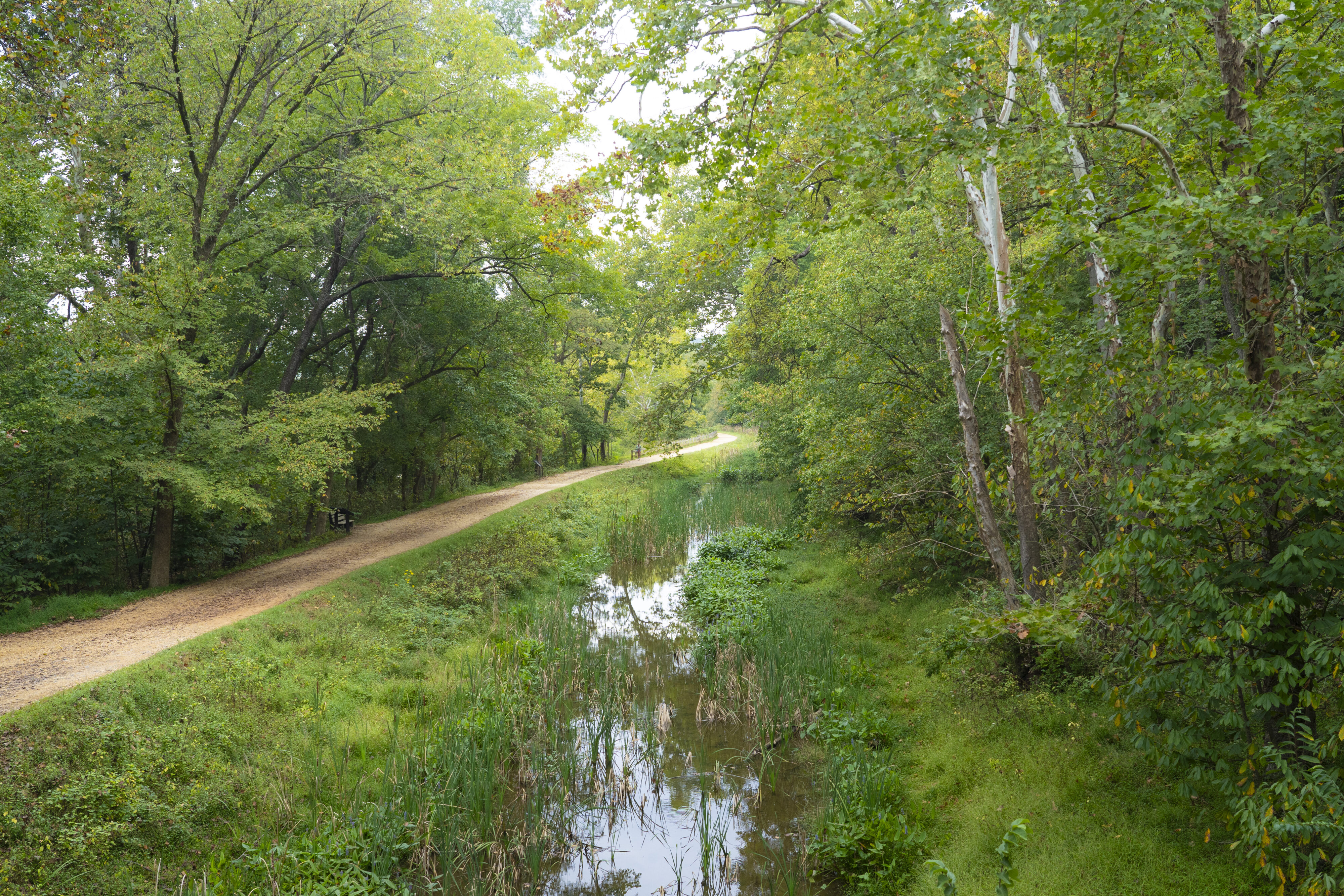
The Chesapeake & Ohio Canal Trail stretches from Washington, D.C. to Cumberland, Maryland.
Clair Sapilewski

Clair Sapilewski
American University
March 02, 2026
Clair Sapilewski
American University
By mile 46, I could recite the sentence that begins the Chesapeake & Ohio Canal Trail’s informational signage:
“Stretching from Washington, D.C. to Cumberland, Maryland, the Chesapeake and Ohio Canal is a 184.5 mile long testament to human ingenuity and our transportation heritage.”
It was 9 a.m. on Sept. 28, and I had been on the trail for the past 28 hours.
I wanted to learn more about the history, geography and nature of the area surrounding Washington. So, I decided to walk from American University to West Virginia. The route was straightforward: take the historic C&O Canal Trail northwest for 60 miles over the course of two days.
Over my journey, I witnessed the trail’s ability to connect people of diverse backgrounds both with each other and with American history. Visitors to the C&O Canal Historic Park said they value the nature, peace and unique transportation utility the trail provides.
The C&O Canal’s story stretches back to 1774, when George Washington dreamed of a canal that could carry people and cargo by boat from the Chesapeake Bay to the Ohio River Valley, according to a National Park Service article on the canal. In the end, the canal never reached either of those points.
“It was an epic failure since day one,” said National Park Service Volunteer Doug Kraus.
The project was over budget. Workers suffered from disease, starvation and inhumane working conditions. The Potomac’s tendency to flood also caused damage along the way, according to the Canal Trust’s history page.
The C&O Canal Company finished construction in 1850, with the canal stretching from Washington to Cumberland, according to the Canal Trust’s history page. The canal was operational until 1924, according to a booklet written by historian Barry Mackintosh. Afterward, a movement started to preserve the canal’s towpath for recreation seekers and outdoor enthusiasts. Jon Wolz, a C&O Canal Association member and longtime canal-goer, started exploring the trail at a young age.
“I biked and hiked the entire canal when I was about 12 or 13 years old,” Wolz said.
As a Boy Scout, Wolz said he testified before a Senate subcommittee in December of 1970 on why the C&O Canal should become a National Park site.
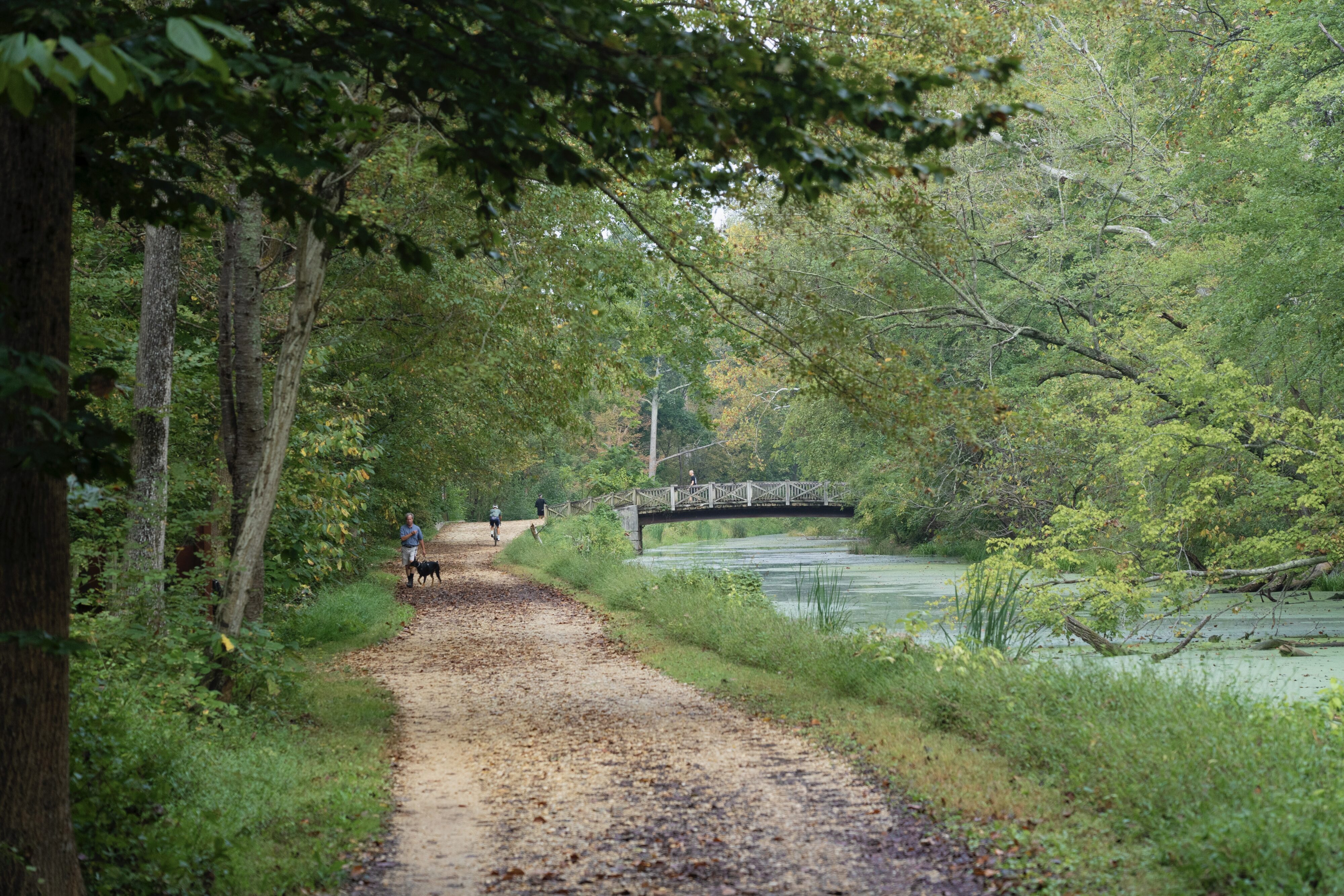
Congress designated the canal area as a National Historic Park in 1971, according to the park service. Since then, it has been utilized by bikers, runners, hikers, photographers, painters, kayakers, ice skaters, fishermen and at least one student journalist walking to West Virginia.
Due to recent funding cuts to the park service, the C&O Canal Historic Park is experiencing a lapse of appropriations, according to a June 29 Huffpost article. Wolz said the cuts might mean the park has a more limited ability to repair trail damage. According to the article, at least five trail employees have left since the beginning of the Trump administration.
“Right now, it doesn’t look too good because they’ve lost a lot of staff this calendar year. People took early retirement and they can’t rehire people, the funding’s been cut,” Wolz said.
Dick Stoner, a board member of the C&O Canal Association, said he hasn’t seen significant changes.
“I don’t think there’s any crisis to worry about,” Stoner said.
My walk coincided with the Trump administration’s executive order aimed at painting a lighter picture of American History in National Parks. A sign near the beginning of the trail asked for viewers to look out for “any signs or other information that are negative about either past or living Americans or that fail to emphasize the beauty, grandeur, and abundance of landscapes and other natural features.” The administration has also asked Harpers Ferry to remove some signs related to slavery, according to a Sept. 15 Washington Postarticle.
I first stepped foot on the trail on Sept. 27 at 5:10 a.m., after walking through Battery Kemble Park for two miles down the hill from campus.
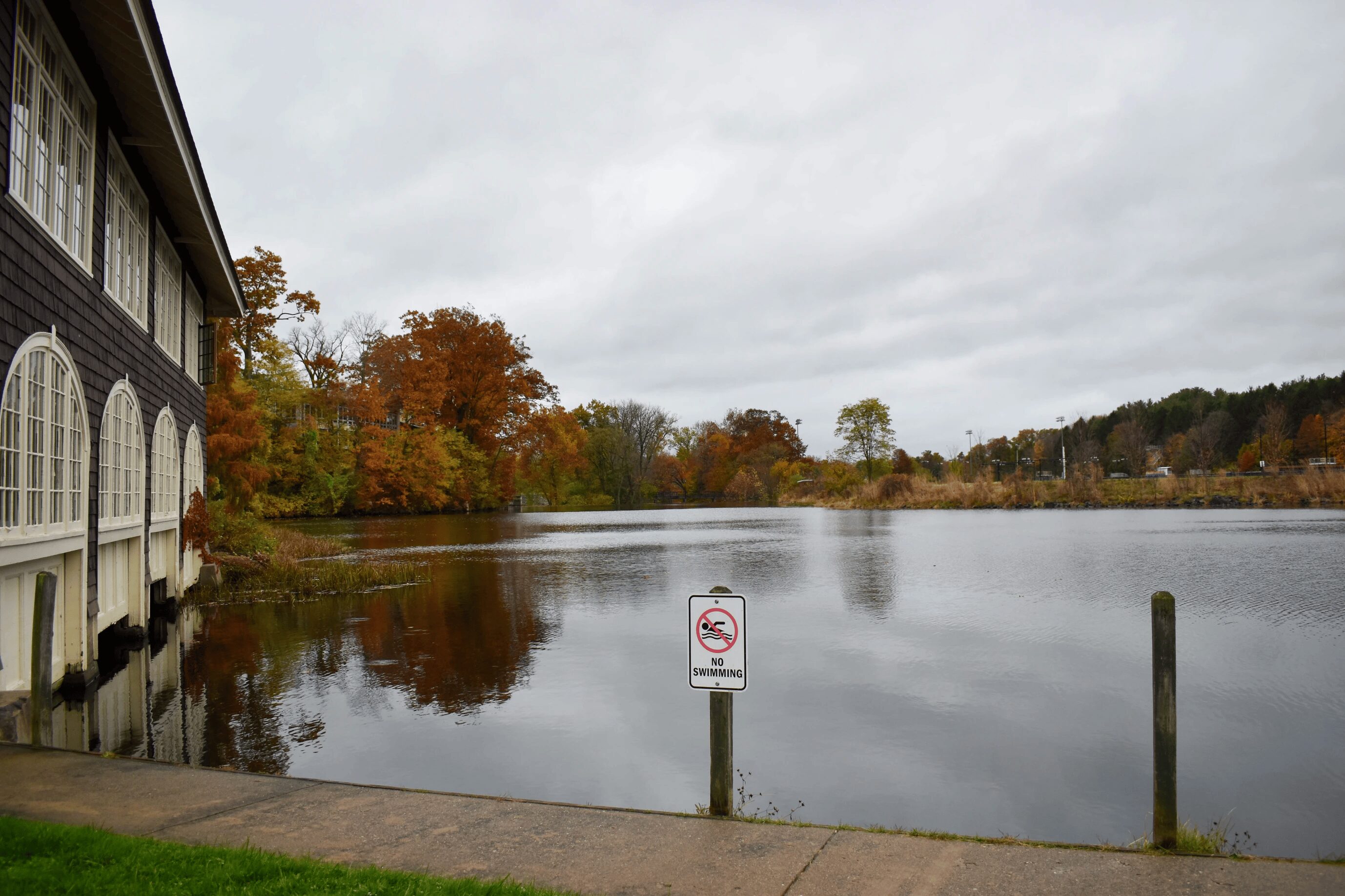
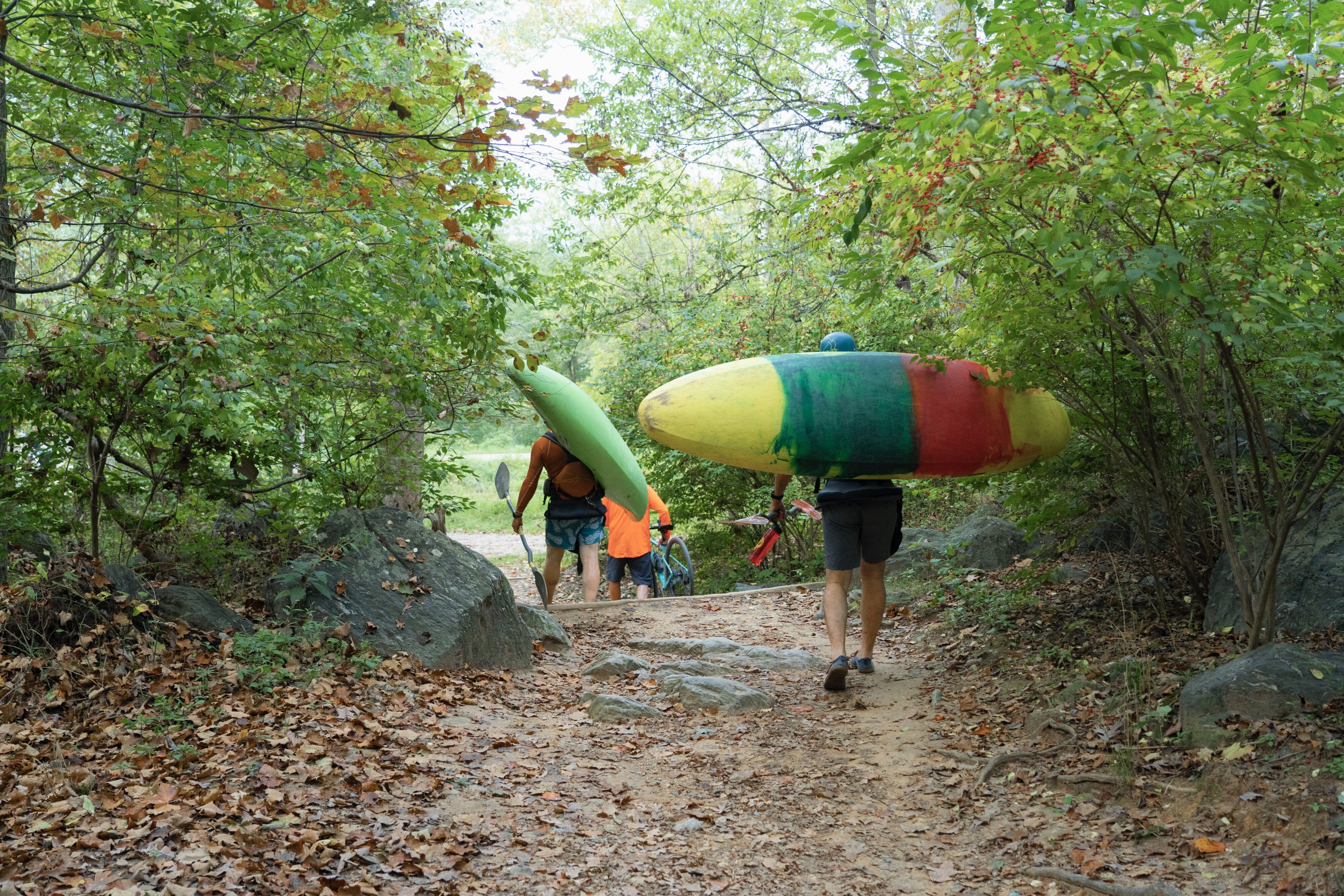
By mile eight on the C&O, the dull roar of the Clara Barton Parkway to my right was replaced by the Potomac’s soft rushing to the left, and people carrying kayaks began to appear on the trail.
Relatively frequent paths connected the trail to the nearby river, and kayakers hauling their boats used them to access the Potomac.
Karyna Todd, a white water kayaking instructor, was teaching a class of beginners just off the trail near mile marker nine. Todd and her students were preparing to run Mather Gorge, a spot on the river just downstream of Great Falls. Todd, who has 10 years of experience kayaking the river, said she values the peaceful setting the river offers
“Its crazy to think that you’re so close to D.C. and all this other infrastructure,” Todd said. “It’s just quiet. And you have the cliffs of the gorge and the water and the wildlife.”
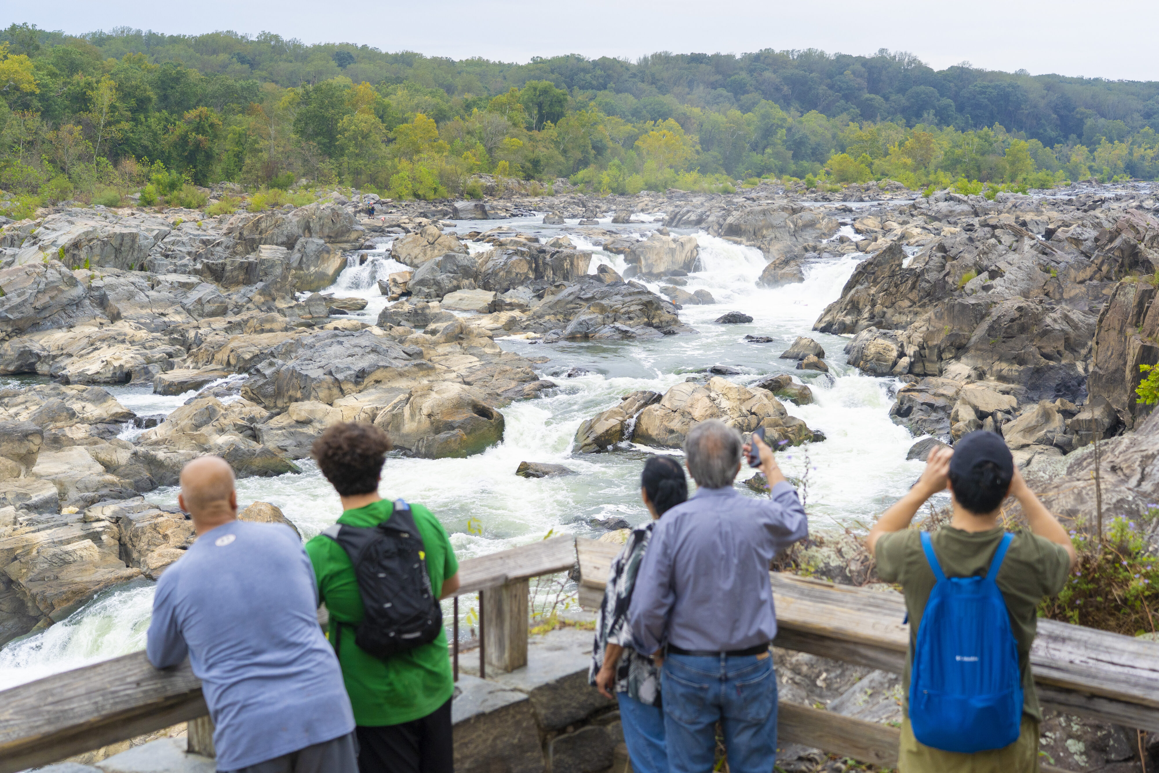
Great Falls was around mile marker 14. By that point, the river banks were dotted with cliffs, rocky islands and deep blue-green pools, a far cry from the usually brown-green waters visible from the Georgetown waterfront.
Great Falls is one of the busiest places in the C&O Canal Historic Park, with around 800,000 visitors annually, according to a park service report. The Billy Goat Trail is situated on the cliffs separating the C&O from the Potomac, and sees especially high traffic, the park service volunteer Kraus said at the Great Falls Visitor Center.
“It’s quiet, it’s serene, it’s scenic,” Kraus said. “People come in all weather.”
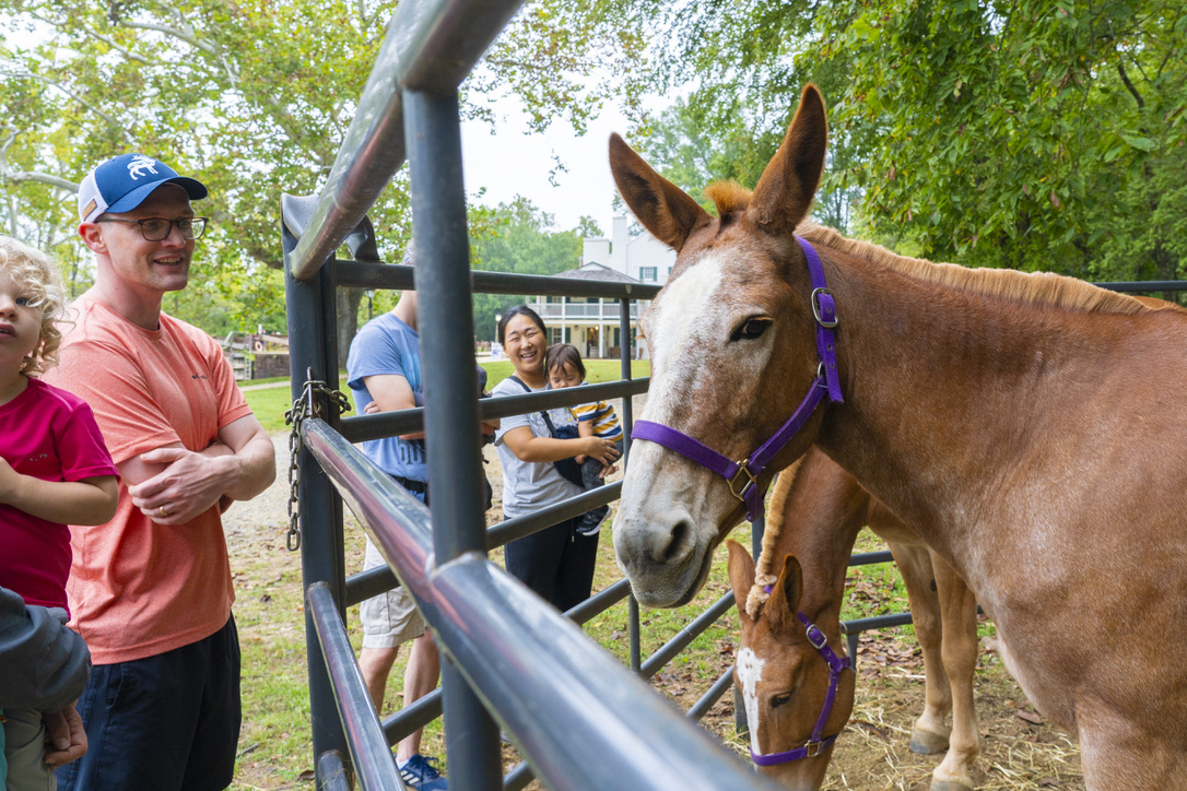
At the visitor center, I ran into Jen and Julie, park service mules who teach visitors about canal history. These animals are the engines that once pulled the canal boats from the towpath.
Off the trail to the left, there was a cove with a shell beach and a few photographers capturing the views. Taking a detour off the canal, I found Rob Trek and Robin Collie, photography enthusiasts who said they come to the area frequently.
“You know, I call it the beach,” Trek said. “The water is really calm here, it’s a nice contrast to the waterfall just further down.”
Both are members of the Virginia Beltway Photography Meetup and said they come out to Great Falls every month or two to take pictures.
“When it’s not the river itself or the rock formations, there’s old shacks and houses and ruins,” Collie said. “So there’s always something to photograph in any season, though I do prefer fall.”

Miles 18 to 30 were the hardest. Walking over 30 miles in a day is challenging. Walking over 30 miles for two days straight proved to be a serious trial.
A little past mile marker 30, at around 5:30 p.m., I reached my home for the night: Lockhouse 25.
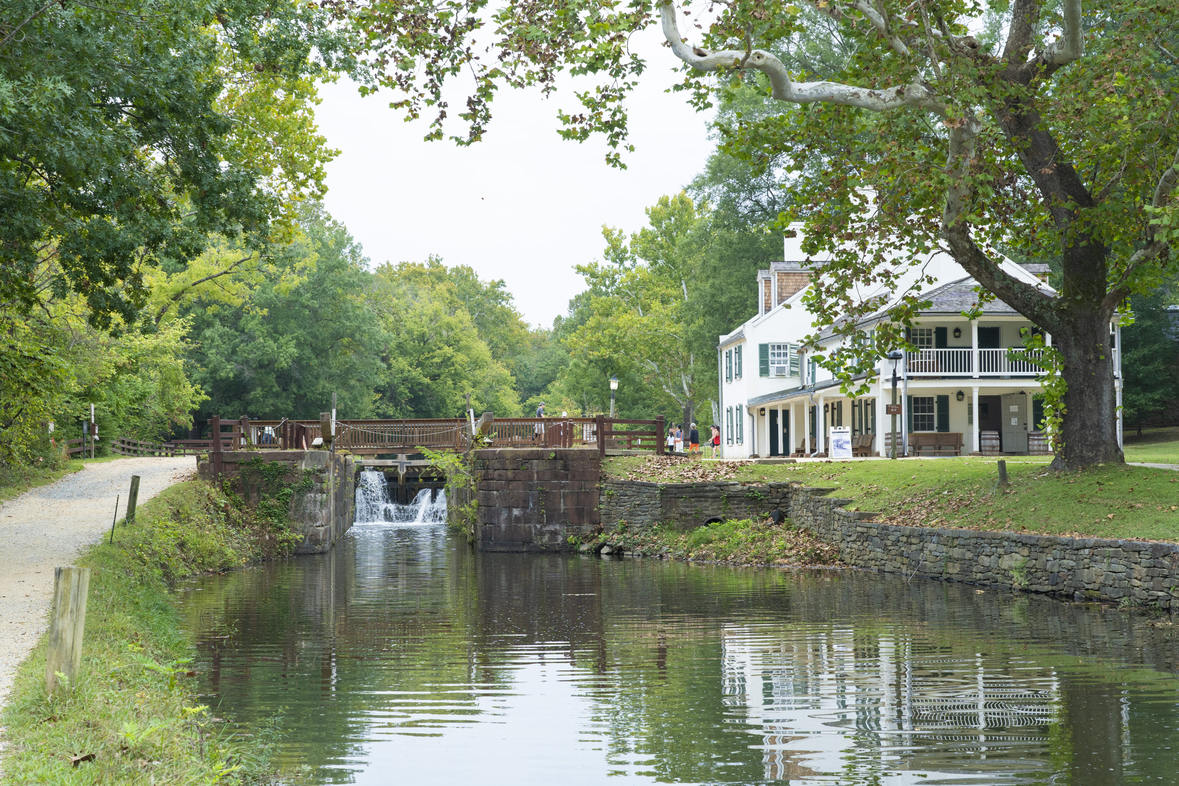
Locks are mechanisms that lift and lower boats by closing a boat into a contained compartment, then filling that compartment with water to raise the vessel, according to the park service. Lockhouses were built for lockkeepers and their families to live in, according to the park service. Lockhouse 25 was built in 1830, according to the C&O Canal Trust, and lacks running water and electricity. The house has two floors and a basement. There’s places for eight people to sleep and plenty of room downstairs for eating.
There was once a thriving settlement around Lockhouse 25, according to a National Park Service sign next to the lockhouse, but when Virginia left the Union in 1861, the Potomac became the line that divided the Union and Confederacy. The Civil War began and militarized the settlement, according to the sign. The Canal itself became a resource both sides coveted, with Confederate troops attempting to disrupt its operation and the Union army using it to transport supplies, according to the park service.
The upstream battle of Ball’s Bluff in 1861 resulted in documented observations of bodies floating down the Potomac, earning this part of the river the name “Haunted House Bend,” according to the C&O Canal Trust.
I tried not to think too hard about those stories as I settled into the Lockhouse for the night. Nor did I dwell on the fact that “Lockhouse 25” didn’t sound like a bad title for a horror movie. I also didn’t linger on the multiple guest book entries that mentioned seeing ghosts and hearing a woman humming through the night.
After a quick lockhouse photoshoot, dinner of packed snacks and a few rationed sips of water, — I found no potable water between mile 23 and mile 57 — I took one of the provided lanterns up to the second floor and fell asleep before 8:00 p.m.
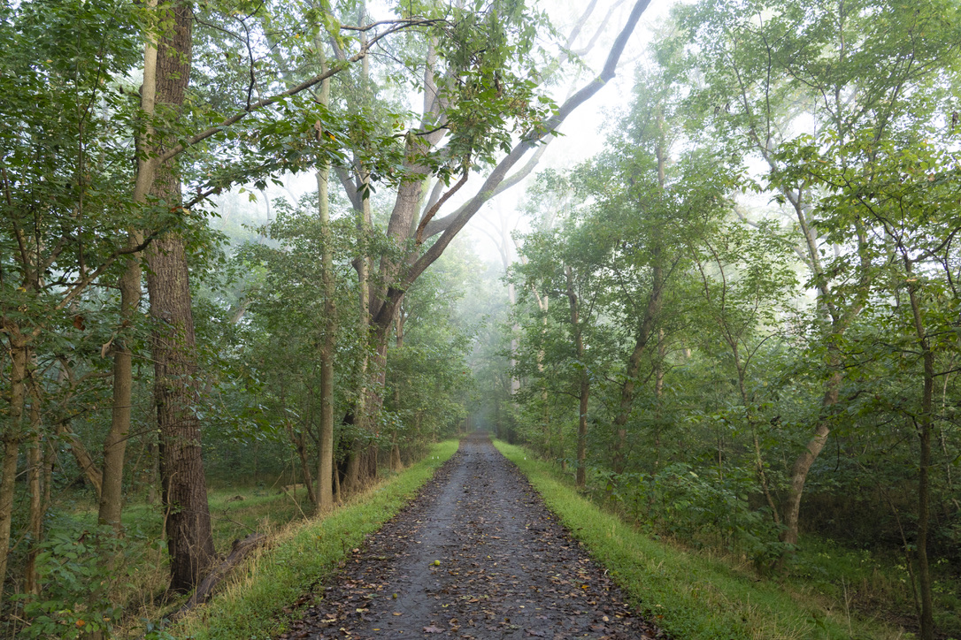
I hit the trail at 3:40 a.m. the next day. For the next three and a half hours, I walked in total darkness.
Unlike the sky above the trail in Washington, there were stars over this rural stretch of trail. With my flashlight off, I let my eyes adjust as I walked. The constellations Cassiopeia and Orion watched as I clocked in 10 miles before the sun rose. The barred owls’ hoos, dogs’ barks and occasional gurgling of the Potomac cut through the darkness. After my eyes adjusted, I began to spot faint blueish pinpricks of light in the leaves on the forest floor. This phenomenon was likely created by bioluminescent fungus, popularly known as fox-fire, according to a 2015 University of Chicago article.
The sun had risen by mile 42, where I crossed Monocacy Aqueduct over the Monocacy River. The aqueduct is the biggest of the 11 built to carry the canal over the various river features in its path, according to the park service.
Around mile 50, at Point of Rocks, Maryland, I noticed park service signs warning visitors to be careful of nesting peregrine falcons. On my left, I spotted a pair perched on the cliff above.
Upriver about seven miles from Point of Rocks sits the historic town of Brunswick, Maryland. Brunswick was one of the only places where restaurants, cafes and shops were within a few minutes walk from the trail. At mile marker 55, I made my way into town.
The settlement had just a few hundred people until the late 1890’s, when the Baltimore & Ohio Railroad built a freight yard there. By 1890, Brunswick’s population had increased to several thousand, making the town a textbook railroad boomtown, according to the city’s history page.
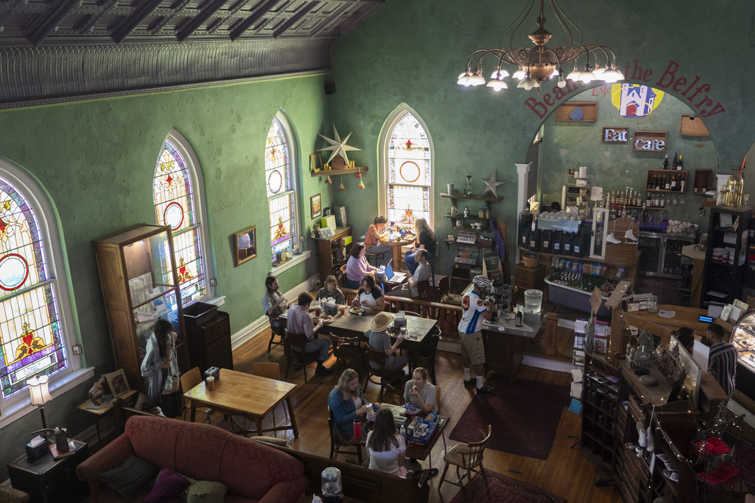
The train passed and I made my way to Beans in the Belfry, a coffee shop that I had been eyeing on my map for the past 10 miles. A guitarist and violinist showed up and began playing fast-paced tunes. I sat in the colorful light from the stained glass windows and ate tiramisu while listening to an impromptu Appalachian folk concert.
A block down the street sits the Brunswick Heritage Museum. Free to enter, I stopped inside to get my National Park stamp and was welcomed by museum volunteer David Roberts and, a few minutes later, museum President Julie Kloetzli.
“Julie!” Roberts said. “This is a lady who is going to write an article!”
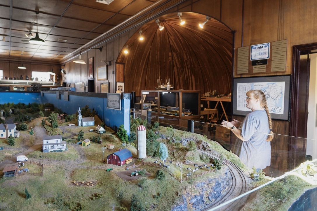
The museum has three levels, each detailing an aspect of the town’s history. The top floor is the museum’s crown jewel with a model train of the B&O Railroad that stretches across 1700 square feet, Kloetzli said.
“Most people come here for the third floor, and unfortunately it’s closed today,” Kloetzli said.
After we talked for a minute, Kloetzli changed her mind.
“Come with me.”
We took the elevator to the third floor of the building as Kloetzli talked more about Brunswick. The town prides itself on being especially biker and hiker friendly, Kloetzli said. She gave me a tour of the exhibit, pointing out the tiny versions of Brunswick, Harpers Ferry and Union Station. Kloetzli said she has been living in Brunswick 12 years, and has been the museum’s president for the past 10.
“You’re talking to royalty,” Roberts said.
There are 5.7 miles between Brunswick and Harpers Ferry, West Virginia. Three of those miles are also part of the Appalachian Trail, marked with white blazes on the trees. Rocky islands filled the Potomac once again, and little sandy beaches dotted the riverbank to my left.
I noticed bikers most frequently used the trail. A popular route, four bikers I spoke with said, takes riders from Pittsburgh, Pennsylvania to Washington through the Great Allegheny Passage in Pennsylvania and then the C&O trail.
“Where else are you going to get 350 miles where you can do this on such well maintained trails,” said Wes Peirce, who said he traveled from Texas to go on a group biking trip with his friend.
After over 60 miles over 36 hours on the trail, I reached Harpers Ferry.
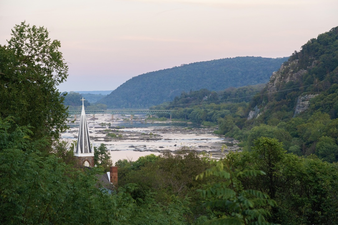
Because of construction on the bridge staircase, I walked an additional mile and a half to meet a shuttle that would take me across the river and into the town’s historic district.
Once on the other side of the Potomac, I walked back across the bridge to the spot above the broken staircase, just above the trail, then turned and strolled into West Virginia.
I walked through the historic downtown of Harpers Ferry as the streets grew darker and slowly emptied of the many who visit as a weekend day trip. The lamps above the cobblestone streets flickered on and illuminated signs harking back to John Brown’s raid, Meriwether Lewis’ adventure, escapes on the Underground Railroad and the Civil War.
I stayed at a hotel in Harpers Ferry and the next morning took the 6:53 a.m. train to Union Station, undoing my two days of walking in a matter of an hour and a half. On the ride, I looked out the window and watched the trail’s landmarks speed by.

A project of

in collaboration with