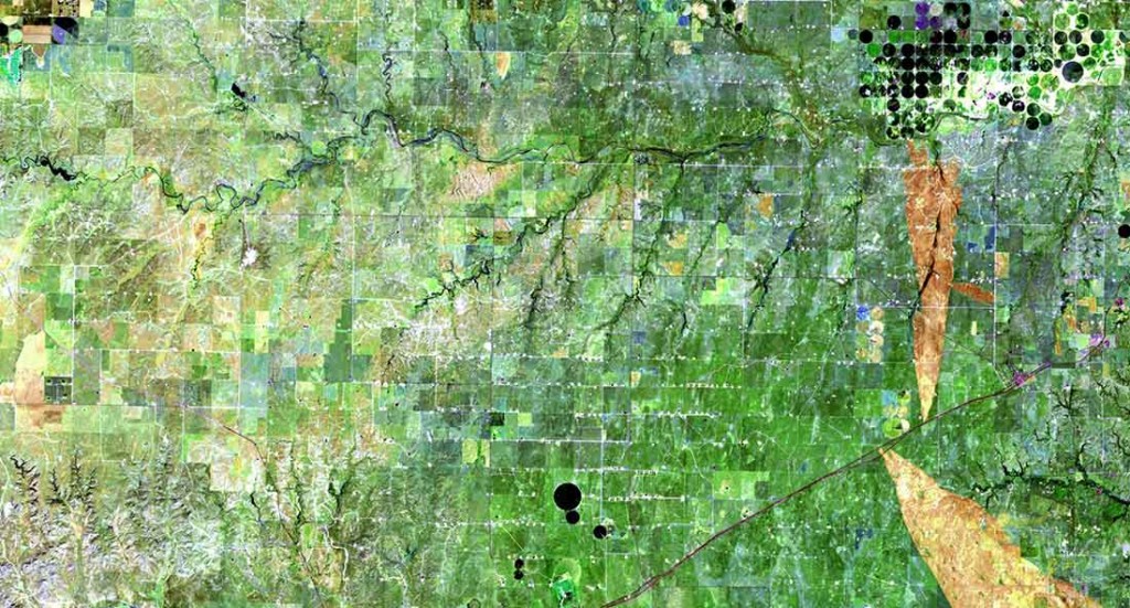
Texas oil and agricultural fields taken by the Landsat 8 satellite. (Image courtesy U.S. Geological Survey)

Texas oil and agricultural fields taken by the Landsat 8 satellite. (Image courtesy U.S. Geological Survey)
By Mariah Quintanilla
What do data and satellite imaging have to do with solving world hunger? Everything, it seems. New surveying techniques and open source imaging of diminishing, available and potential cropland are the first steps in assessing problems and solutions for global food security.
To prevent further hunger, researchers must identify factors that may lead to food instability, such as areas prone to frequent drought, floods, erosion or sea level rise. Researchers stressed the need for accurate data and efficient satellite imaging of small family farms and large agricultural systems in a seminar on monitoring food security at this year’s American Association for the Advancement of Science (AAAS) conference in Boston.
The World Food Programme of the United Nations estimates that about one in nine people – about 830 million of us – go to bed hungry every night. The United States Department of Agriculture (USDA) reports that approximately 870 million people around the world do not have access to nutritious food. With advanced technology and modern open source databases, it’s hard to understand how even more data and better satellite imaging will help the problem of hunger.
Why do we need good data?
Data will not feed the world, but an accurate aggregation mapping of high-risk areas and under-utilized agricultural lands from every part of the world is the first step. Conclusions drawn from data and imaging will inform government policy decisions that will mitigate the effects of climate change on agricultural systems and help monitor volatile food systems.
“Most agriculture around the world is not like Iowa,” said Michael Steiner of the USDA’s National Agricultural Statistics Service, who spoke at the seminar. That is, most farms around the world are not cut into seemingly perfect squares from aerial views of places. The majority of the world’s agriculture occupies irregular plots owned and run by families in rural areas, and often consists of a mix of crops. Collecting data from farmers in remote rural areas is difficult, and often results in inaccurate estimates of the total area of agricultural land.
“There is a great need for improvement in agricultural statistics around the world,” said Steiner. “The amount of data has steadily decreased over the past 30 years.”
What data-gathering tools are at our disposal?
Jacques Delincé, a senior statistician with the Food and Agriculture Organization of the United Nations (FAO) speaking at the seminar, currently utilizes a variety of programs to aggregate and analyze agricultural data. Some relatively accessible sources include Google Earth Pro, Google Drive and GADM—a spatial database of varying levels of administrative areas in the world. Other more specific tools, however, can better assess certain crops and terrain, or can vary depending on the question in mind.
For example, radar imaging is optimal for surveying rice fields, because it can pick up the humidity and roughness of the soil, said Delincé. He also uses various types of remote sensing, or land data gathered from satellites in space. Sentinel-2, a satellite launched by the European Space Agency, is preferable for assessing small fields, while the satellite Landsat 8, part of the United States Geological Survey, is better suited for medium sized fields. Though the technology and data appear boundless, Steiner pointed out the many challenges with gathering good agricultural data.
How are we improving our agricultural data-gathering methods?
One problem is there is insufficient funding for good data, he said. When organizations do have good data, they are often limited in qualified staff that can analyze the data and draw accurate conclusions. Additionally, drones are not yet effective in surveying rural farming land because they can’t delineate between different crops and weeds. These challenges only leave room for improvement and innovation, said Steiner.
The FAO has implemented a Global Strategy for Improving Agricultural and Rural Statistics program. One of the speakers, Raka Banerjee, is the project coordinator of a Living Standards Measurements Study established by The World Bank. They are engaging with rural African farmers in a household survey program to gather agricultural data and improve survey methods where technology is limited.
“Sometimes it feels like (gathering and analyzing data is) a little upstream, and what we need are those interventions that are going to improve food,” Banerjee said.
A collection of data and images will be used to assess the state of agriculture around the world, and inform governmental policy that can support at-risk agricultural systems.
“To even get to the point where we can talk about policies to intervene on behalf of these farmers, we actually need the data first,” she said. “I think people think we’re already there, but we’re not.”