Revolutionary weather satellite to aid in earlier warning of severe storms
By Kelly Calagna
CAPE CANAVERAL, Fla. – NOAA’s revolutionary weather satellite successfully launched Saturday from the Kennedy Space Center at 6:42 p.m. EST. The Geostationary...
NOAA’s revolutionary weather satellite successfully launched Saturday from Florida. This means earlier warnings, expected to save lives from severe weather situations.
CAPE CANAVERAL, Fla. – NOAA’s revolutionary weather satellite successfully launched Saturday from the Kennedy Space Center at 6:42 p.m. EST. The Geostationary Operational Environmental Satellite (GOES-R) means earlier warnings, expected to save lives from severe weather situations.
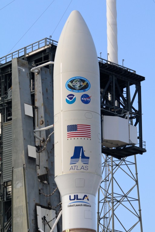
The GOES-R satellite is located in the nose cone of the rocket. (Kelly Calagna/MEDILL)
GOES-R, called GOES-16 as soon as it detached from the booster, is the first in a series of next generation satellites for weather monitoring set to replace the current NOAA GOES network. “It’s going to be like instead of seeing black and white television, HD,” said Joe Pica, director of the Office of Operations at the National Weather Service in a mission briefing at the space center on Thursday.
Hurricane Matthew delayed the weather satellite’s launch twice due to damage to space center facilities and equipment last month, as well as a minor booster issue. But with clear conditions and all units go, the United Launch Alliance (ULA) Atlas V rocket finally got the spacecraft off the ground in a NOAA and NASA partnership.
The geostationary satellite will be able to monitor a vast swath of the the Western Hemisphere longitudinally from the east coast of New Zealand to the west coast of Africa and from latitudinally from Canada to Chile. With three times more channels than current weather satellites, it will track severe weather with intensified accuracy, giving immediate updates and more reaction time with warnings about hurricanes, typhoons, lightning, wildfires, tornadoes and even rough flight conditions. The imaging resolution will be four times as powerful as what is available now, so advanced that it will be possible to see the waves in the clouds that cause turbulence.
“We will see features with GOES-R that we have never been able to see before,” said Steven Goodman, GOES-R program scientist with NOAA.
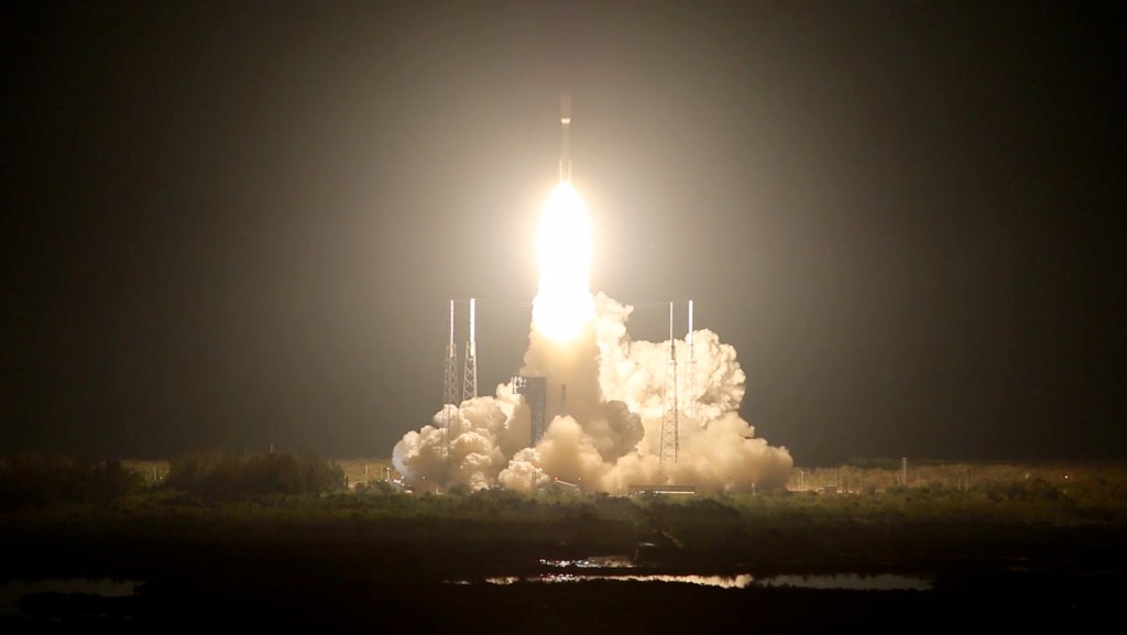
The launch of GOES-R occurred Saturday at 6:42 p.m. EST at the Kennedy Space Center in Cape Canaveral, Florida. (Kelly Calagna/MEDILL)
Spectral images of Earth will occur every five minutes and can be taken up to every 30 seconds in areas of interest, which is five times faster than the capabilities of current satellites. This frequency in information helps agencies such as FEMA and NOAA better plan for evacuations and quickly get grounds crews where they are needed most. “We are excited for GOES-R because it is going to help us do our jobs better,” Pica said.
The ability to more accurately map lightning aids the organizations in predicting the behavior of a hurricane, technology Goodman said would have greatly assisted the Caribbean in preparing for the rapid intensification of Matthew just last month. Goodman also said the use of the imaging could help the people see “that the risk is real and the storm is coming at them, and they will maybe be more likely to take action. And that is what we need, people to take action to be safe.”
Additionally, GOES-16’s environmental monitoring programs will aid in documenting the effects of climate change on extreme weather. “Right now we don’t know what the [normal] variation for extreme weather is,” Goodman said. But the 20 years of data GOES-16 will be collecting will extend the 17 years of data from the NASA Tropical Rainfall Measuring Mission (TRMM), creating a sound climate data set “and we can look for those variations,” Goodman said.
GOES-16 also will be keeping an eye on the sun. Its six instruments are designed to be Earth-pointing, in situ-pointing (near environment), or solar-pointing. The solar-pointing instruments will be able to detect solar flares, intense radiation blasts from the sun that can impact telecommunications satellites and electric power on Earth. When necessary, the satellite can send out warnings to shut off power grids to protect them from being destroyed from electromagnetic disturbances.
It will take GOES-16 nine days from its launch date to position itself in its planned orbital route and about five months before it is fully operational. News and updates on the satellite are available at goes-r.gov.
“Accuracy turns into time for us, and the one thing you can’t get back during a response to an emergency is time,” said Damon Penn, assistant administrator of the Response Directorate at FEMA, “Our relationship with NOAA and the kinds of products NOAA provides for us are critical to what it is that we do.”
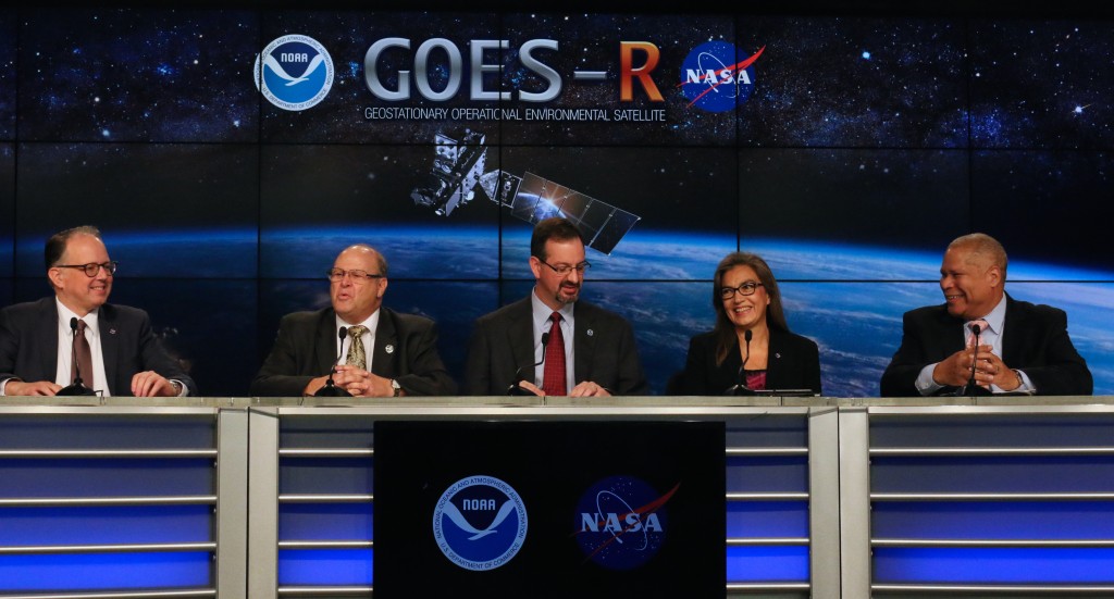
(From left to right) Steven Goodman, GOES-R program scientist, NOAA; Joe Pica, director of the Office of Operations at the National Weather Service; Sandra Cauffman, deputy director of the Earth Science Division at NASA Headquarters; and Damon Penn, Assistant Administrator of the Response Directorate at FEMA, give a mission briefing at the Kennedy Space Center press office on Thursday. (Kelly Calagna/MEDILL)
This website uses cookies to provide you with an improved and personalized experience. By using this site you agree to our use of cookies. Please read our cookies policy for more information on the cookies we use and how to delete or block them.