Looking Up: Protecting human, climate history in the Scottish Highlands
Sam Kelley, an assistant professor in quaternary geology at the University College Dublin, collects rock samples from a boulder deposited by a glacier during the Last Glacial Period in Scotland’s Cairngorm Mountains.
Illuminated by the gentle blue glow of her monitor, Alice Doughty boots up her favorite video game: the one where she grows glaciers.
To play the game, Doughty feeds her computer topographic and climatic data and then compares it to information gathered by researchers 2,830 miles away. From behind her desk in Maine, Doughty intently watches the game unfold, as the code digitally reconstructs giant, 15,000 to 11,000-year-old glaciers in Scotland’s Cairngorm Mountains.
“You have to be a pretty specific kind of nerd to enjoy this type of video game,” Doughty said.
The game is actually a climate model, showing the Cairngorm Mountains after ice began retreating. Doughty, a lecturer in Earth and climate sciences at the University of Maine, developed the model for “Looking Up”, an interdisciplinary study conducted by University College Dublin (UCD) between 2021 and 2023.
“Looking Up” explored the movement of hunter-gatherer groups during a turning point in human and climate history in the United Kingdom’s largest area of high ground, the Eastern Highlands. The goal is to preserve cultural heritage and advance understanding of how people and landscapes interact and respond to climate change. This work will become critical as reforesting efforts bury the past and atmospheric temperatures inch toward 3.6 degrees Fahrenheit above pre-industrial levels, threatening the stories preserved in the landscape.
“We are not only interested in where these glaciers were and when they were at those locations for the sake of understanding glaciers and climate change,” Doughty said. “We also want to know for the sake of piecing together part of human history.”
Reforestation efforts cut both ways
Rewilding efforts in the Scottish Highlands promise ecological benefits, but also threaten the land’s archeological record.
The United Nations established the Sustainable Development Solutions Network in 2012, which promotes global sustainability through research, policy analysis, education, and global partnerships. One of the specific targets for the network is to increase biodiversity and conserve terrestrial ecosystems essential to the well-being of species, including humans. In recent years, this goal has actualized in the Scottish Highlands in the form of rewilding projects, such as Trees for Life.
Planting trees in mountainous areas might improve biodiversity and limit atmospheric carbon levels, but it also might erase key parts of the past.
“If you take a landscape and you cover it with trees again, that does have an impact on the archeological features,” said Graeme Warren, one of the principal investigators for “Looking Up.” “Roots will work their way through things and that can damage and disturb those [areas.]”
According to Warren, an archeology professor at UCD, this doesn’t mean there shouldn’t be rewilding, but there should be awareness of the archeological consequences of altering these landscapes.
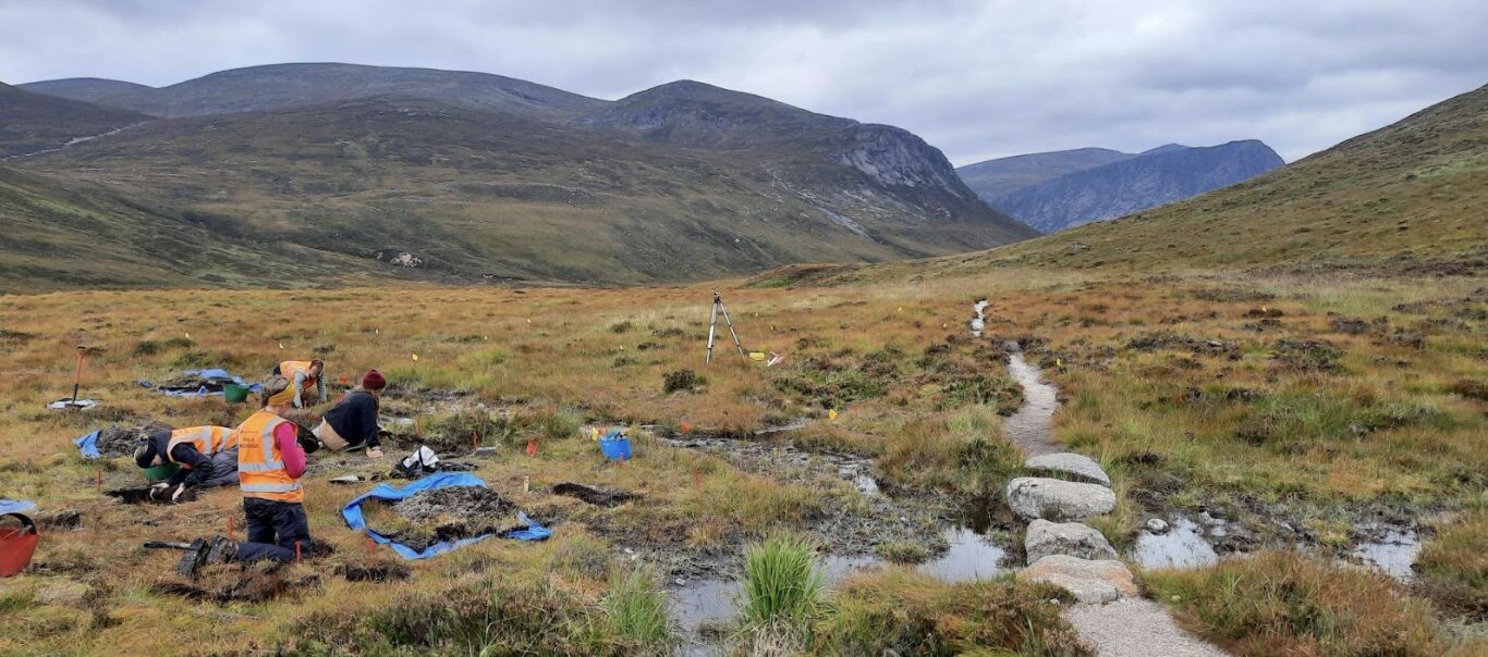
The team’s first fieldwork in the Cairngorms started in 2013. Warren and his team surveyed the land and excavated sites to identify signs of hunter-gatherers.
Armed with a trowel and sieve, Warren spent days exploring peat-covered ridges and digging test pits. Warren dug carefully through the acidic soil, in search of small stone tools that would have been used for drilling, slicing through animal skins, and cutting plants in the Mesolithic, a Stone Age period about 10,000 years ago.
According to Warren, small sites from the Mesolithic — when people were just beginning to transition from nomadic life to semi-permanent settlements — are difficult to find, which is why they need to be protected.
One notable thing Warren’s team uncovered was a small campsite. Thousands of years ago, someone stopped for a meal and to repair a few flint tools, and left traces of a small tent and firepit.
“We have this little window into a really, really short period of time, about 8,200 years ago,” Warren said.
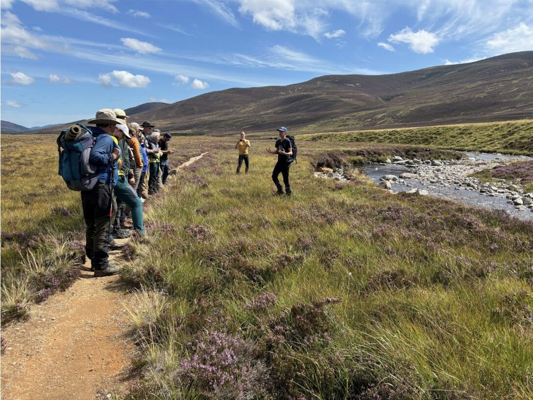
A team of UCD archeologists digs a grid of 30 shallow holes in a valley in the Cairngorm Mountains in search of prehistoric signs of life. (Courtesy of Graeme Warren)
In the “Looking Up” project, archaeologists identified, excavated, and reconstructed these sites so landowners could make informed decisions about where to plant trees in these areas.
Where archaeology meets geology
The researchers aimed to map predictions of where cultural heritage sites might be hidden by analyzing the distribution of artifacts they found and what the landscape might have looked like thousands of years ago. Especially since the landscape was changing with warming temperatures at the end of the last ice age. To do this, Warren collaborated with Sam Kelley, a climate scientist and assistant professor at the School of Earth Science at UCD.
“The question we were addressing was: What did the landscape look like when the first people came back to Scotland after?” Kelley said. “The most fundamental question was: Was there ice on the landscape, and where was it?”
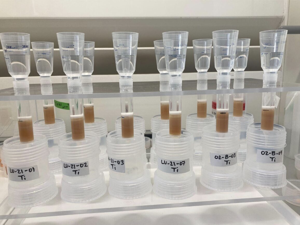
Elements used for dating rock samples are separated from other minerals and sediments in the UCD lab. (Courtesy of Sam Kelley)
Kelley visited the Cairngorms twice during the span of “Looking Up” to collect rocks from along the mountain ridges. The ridges of boulders give evidence of where and when the glaciers retreated, pushing the rocks aside. As Warren scoured the valley for bits of flint and sharpened stone, Kelley and a team of geologists searched for boulders from moraines, or ridges of rock and sediment carried and deposited by glaciers, and bedrock from high mountaintops.
Kelley bent over each boulder and used a hammer to tap against the chisel steadied by the toe of his hiking boot. The rock fragments were sent to Purdue University in Indiana for cosmogenic exposure and radiocarbon dating. By calculating the number of beryllium-10 and carbon-14 atoms on the surface of the boulders, the scientists could tell how long ago a glacier dropped the rocks, and thus where the ice was at a given time.
To visualize where the ice was and what melting would have looked like on the plateau, Kelley had weekly calls with Doughty. Doughty would carefully tweak the variables of her video game — the temperature and precipitation inputs — to grow glaciers matching the dates and locations Kelley shared.
Doughty’s models narrowed the vast terrain to an area of interest for the archeologists. When combined with data collected in the field, the project gave insights into where Mesolithic humans were and what they were doing at specific time periods.
“If you are trying to find a needle in a haystack of the oldest possible sites of where humans were,” Doughty said, “it helps if you can close off all the places that humans didn’t even have access to.”
The researchers found people came in about 1,000 years after the ice melted. Kelley explained these prehistoric groups followed resources. They would have trailed the animals and grasses as they returned to the deglaciated mountains.
The “Looking Up” team shared the results of their studies with community members and landowners through public discussions at the Mar Lodge Estate, in western Aberdeenshire, Scotland. The team also collaborated with artist Richard Skelton, who communicated the importance of the work through poetry and electronic music. They also shared the interactive and predictive maps they developed with participants during these sessions.
Beyond informing land management decisions, “Looking Up” brought archeologists, geologists, modelers, and citizen scientists together in the name of mitigating future climate change, without compromising the past.
“It was sort of doing science the way that I personally think science should be done, with a very interdisciplinary group,” Kelley said.
Graeme Warren instructs a team of archaeologists and geologists before a day surveying the field for artifacts and erratic boulders in the Cairngorm Mountains. (Courtesy of Graeme Warren)
This website uses cookies to provide you with an improved and personalized experience. By using this site you agree to our use of cookies. Please read our cookies policy for more information on the cookies we use and how to delete or block them.